Includes most features of SPIP™ software created by Image Metrology.
⇒ Detect any feature – choose from a range of feature detection methods based on different segmentation principles:
- threshold segmentation (detect particles using user-defined thresholds)
- watershed segmentation (using the method defined in the ISO 25178-2 standard)
- edge detection (apply an edge detection filter)
- circle detection (detect round or spherical particles).
⇒ Multi-channel file management – in the case of a file containing several data channels, choose which data channel to use for feature detection.
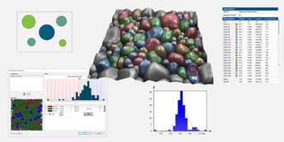
⇒ Particle classification – detected particles can be grouped into different classes based on their characteristics, such as their geometrical shape, height or size.
⇒ Spherical caps – calculate and show spherical caps contained in particles.
⇒ Display options – access a wide range of graphical representations and customize display of results:
- overlay (see particles in pseudo-color)
- motifs (see on a monochrome background)
- colored (use color and manage transparency)
You can also choose to superimpose a pseudo-color view of particles on 3D surface topography.
⇒ Generate charts and statistical results for all particles, subsets of particles or individual particles.
⇒ Calculate ISO 25178 feature parameters (Spd, Spc, S5p, S5v, S10z, Sha, Sda, Shv, Sdv) and apply Spd (peak density) and Spc (arithmetic mean peak curvature) parameters in tribological studies, for example for plasticity and elasticity.
⇒ Analyze texture direction – display a compass rose showing texture direction(s) – calculate surface isotropy.
⇒ Analyze furrows (dermatology) – detect and visualize furrows above or below a threshold height – calculate furrow parameters: max depth, mean depth and mean density.
Watch our webinar on Particle Analysis with Mountains® by following this link.
Included in:
- MountainsMap® Premium
- MountainsSPIP® Expert
- MountainsSPIP® Premium
- MountainsSEM® Premium
- MountainsSpectral® Premium
- MountainsImage® Premium
- MountainsLab® Expert
- MountainsLab® Premium
Available with:
- MountainsMap® Topography
- MountainsMap® Imaging Topography
- MountainsMap® Expert
- MountainsSPIP® Starter
- MountainsSEM® Color
- MountainsSEM® Expert
- MountainsSpectral® Correlate
- MountainsSpectral® Expert
- MountainsImage® Starter
- MountainsImage® Expert