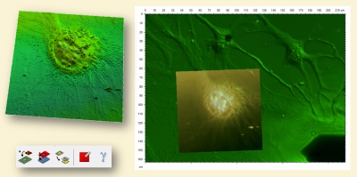
⇒ Combine surface and image data from a single instrument or different instrument types including 3D optical profilers, atomic force microscopes, scanning tunneling microscopes, scanning electron microscopes, fluorescence, Raman, IR, EDX/EDS etc.
⇒ Generate dynamic images or extract a dataset from the results of your colocalization.
⇒ Overlay images on 3D surface topography – view 3D overlays at any zoom level and angle.*
⇒ Convert color and grayscale images into 3D colored pseudo-surfaces (Z-axis in intensity units).*
⇒ Use colocalization with multi-channel data. For example, AFM data comprising numerous signals (height, phase etc.) can be overlaid with data measured using another instrument type (scanning electron microscopy, spectroscopy etc.)*
*Depends on main product purchased.
Included in:
- MountainsSPIP® Premium
- MountainsSEM® Expert
- MountainsSEM® Premium
- MountainsSpectral® Correlate
- MountainsSpectral® Expert
- MountainsSpectral® Premium
- MountainsLab® Expert
- MountainsLab® Premium
Available as an option with:
- MountainsMap® Imaging Topography
- MountainsMap® Expert
- MountainsMap® Premium
- MountainsSPIP® Starter
- MountainsSPIP® Expert